Home

Brochure


¡P PDA with CMT CE-Cruise EX Package: $1885
¡P PDA with CMT CE-Cruise EX & PC-Cruise EX Package: $2885
¡P CMT CE-Cruise EX & PC-Cruise EX Package (without PDA): $2385


Microsoft® Windows MobileTM 5.0/6.0
(Pocket PC)

Built-in GPS and built-in GPS Antenna:
  ¡P  Good performance under tree canopy
  ¡P  Typical accuracy: 1 to 5 m (real-time)
Automated Software Installation
Data Integrity and Validation Integrity

 
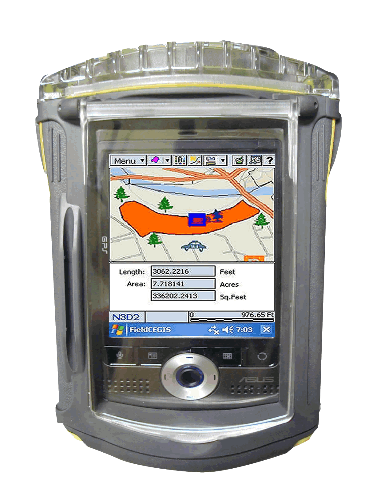
PDA with high-performance GPS
in waterproof case

Actual example from Horton Tree Farm
(900,000 board feet) in Oregon:
 ¡P  Mature and high density Douglas Fir trees
      on 40 acres
 ¡P  Wet ground and wet trees in December 2006
 ¡P  Most GPS would fail under such heavy canopy
 ¡P  Built-in GPS still performed very well
 ¡P  Area measurement error approximately 0.5%
 ¡P  Consistent tracking even under heavy
     canopy
 ¡P  PDA survived harsh conditions

 ¡P Optional waterproof case available


Rugged Waterproof Case
:

Work in rain without worries. No need to open the case during field work.
See through the crushproof plastic case (with hand strap).
Access the touch-screen through the protective film.
Access the CF and SD slots through the top of the case.
Turn off the PDA via the CMT software.
(Turn it back on by pressing the Keyboard key on the PDA.)
Easily open the case in the office.


    CE-Cruise EX 07 Highlights  
 

¡P Cruising Grid Setup
¡P Point & Shoot Cruise Data Entry

¡P Multi-product Data Entry
¡P Error-checking based on tree profile

¡P On-the-spot tree volume results

¡P Access to Navigation from Plot Info screen

¡P Cruised Plot Indicator

¡P Tract/Stand volume and statistics reports

¡P  Load background imagery: MRSID®, PIM
¡P  BaseMap with contour lines

¡P  Import/Export Shape Files

¡P  Thousands of patterns and symbols

¡P  "Free-hand" digitizing capability
¡P  Navigation & Auto-routing with
     Voice Directions
¡P  NMEA-183 GPS data support
¡P  GPS Data Logging: By Time, By Distance
¡P  Offset points or Traverse points
¡P  Nested Points

¡P  Length, Distance and Area measurements
¡P  LLA, UTM, SPC, NEZ and User-Defined
     Coordinate Systems


           Tree Data Entry Form


    PC-Cruise EX 07 Highlights  


Cruise Methods:
100% Cruise
Measure/Count Tally
Fixed Area Plots
Prism Points
Double-Point by Point
Double-Point by Tree
Strip Method
VBAR Tally


Volume Methods:
Built-in Stem Profiles
Built-in Volume Equations
Mesavage/Girard Volume Tables
NVEL Volume Estimator Library
User-defined taper,
volume equations/tables,
VBAR equations/tables, and
Ratio equations


Data Entry and Reporting:
Point & Shoot tree data entry
Multi-product data entry
#Logs <—> Merchantable Height
Extensive error-checking
Tree Volume Display
Exclude Trees, Plots or Stands
Volume reports for Tract/Stand/Plot
Statistics reports


Supports:

"Big BAF"
Height Sub-sampling
Tarif Method
Cumulative Tally


Setup:

Merchandizing specs
User-defined data fields,
DBH, and mechantable heights
Save/Load Cruise Setup

You can do these and more:

Compute required #sample plotse
Merchandize based on tree profile
Combine Cruises
Display Stand acreage by classes

GPS/GIS:
Record Features with
Attributes/Values
Navigation & Stakeout


Geo-reference
Aerial Photos
Merge area boundaries
Set Image/Area Transparency
 

Show Distances and Acreages

Interface with Google Earth®
Save completed map as image file
Cruising Grid
Deed Calls
Coordinate Geometry
Digitize Points/Lines/Areas
Label map elements
Forester's Toolkit
Import/Export (MS®Excel/Access):
Feature Lists, Shape Files
Cruise data, Feature data


Home

Brochure