Advantages of Vectorized Topographic Maps:
- File size. The file sizes of vector maps are small (about 1/3 the size) compared to full raster images. Carry more maps using the same amount of memory on your PDA with Field CE GIS.
- Clarity.
Regardless of how far in you zoom, you will still see the same level
of resolution instead of the pixilated (blocky) lines that you get when
zooming in too close to a regular DRG:
Are you tired of seeing this? Now, you can have this! 
OLD RASTER DRG
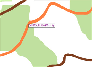
NEW VECTORIZED DRG
- Coordinate system transformation. Work with topo maps in any coordinate system you choose instead of always being stuck in UTM, NAD 27 CONUS, Meters on traditional DRG maps. Easily convert to coordinate systems of your choice for consistency with all of your data.
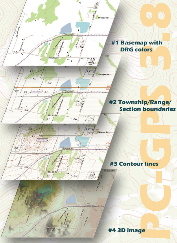
- Several layer options are available for the Vectorized Topographic Maps including: contour lines, township/range/section boundaries, buildings, roads and trails.
- Seamless integration with CMT Basemaps.
Download a Vectorized quad map/DRG Demo here for:
Please view the readme file before you install
| Option | Description | Price |
| #1 | Basemap with DRG Colors | Package of Layers:1, 2, 3 = $50.00 per quad |
| #2 | Township/Range lines and Section boundaries | |
| #3 | Interactive Contour lines | |
| #4 | 3-dimensional image. Also includes contour interval down to 5 feet. | Package of Layers: 1, 2, 3, 4 = $100.00 per quad |
CONTACT
support@cmtinc.com TODAY FOR MORE
DETAILS!!!